|
Information
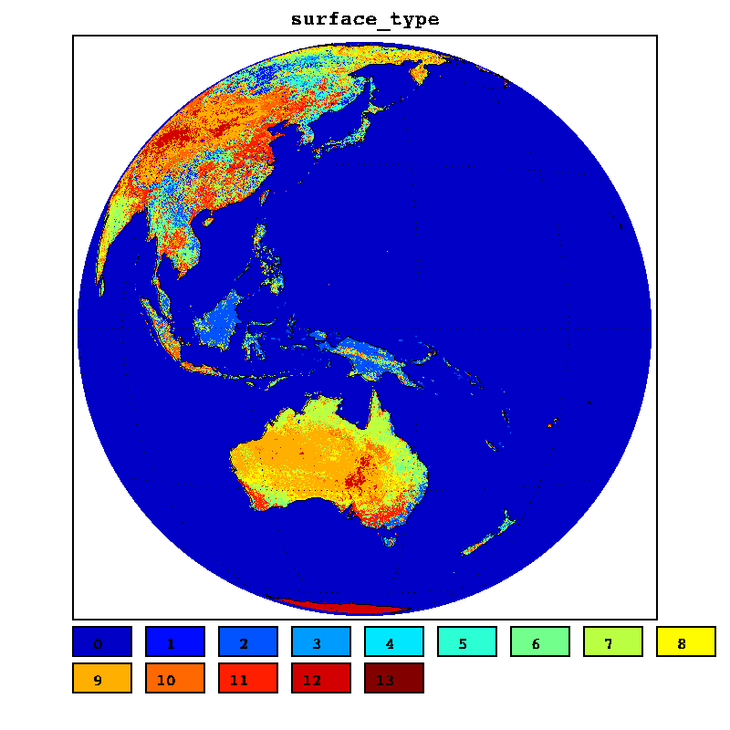
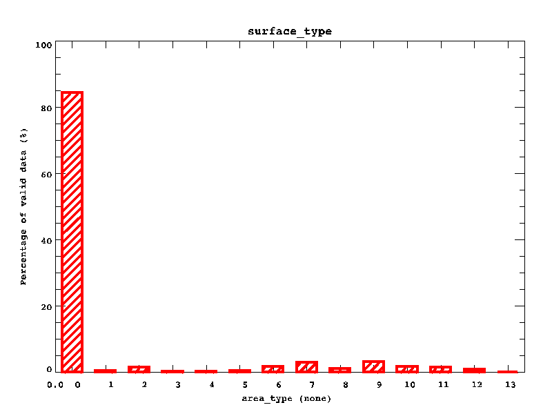
surface_typeVARIABLE_NAME : surface_type STANDARD_NAME : area_type LONG_NAME : none UNITS : none ACTUAL_RANGE : -999.000 -999.000 ACTUAL_MISSING : -999.000 _FillValue : 129 FLAG MEANING : water evergreen_needle evergreen_broad deciduous_needle deciduous_broad mixed_forest woodlands wooded_grass closed_shrubs open_shrubs grasses croplands bare urban : FLAG VALUES : 0 0 0 0 1 0 0 0 2 0 0 0 3 0 Max and Min of Valid Value : 13 0 Average of Valid Value : 1.18427 Standard Deviation of Value : 2.95331 Median of Value : 0.00000 | |
|
Full Disk Image
|
Histogram
|